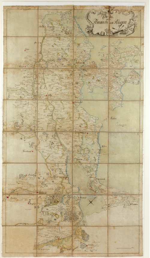
Map with the inscription 'Carta öfwer Pommern och Rügen' (map of Pomerania and Rügen)
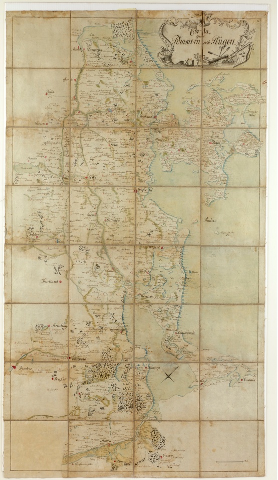
- drawn by hand on paper
- fabric base
- 1756-1763
- length: 130 cm
Heimatmuseum Grimmen owns a remarkable testimony to the Seven Years' War. It is an undated, Swedish map of Western Pomerania in a scale of approx. 1:145,000. The map extends to the north-west, meaning that its was rotated by 45° from true north, placing Darss on the upper edge. The Prussian port city of Swinemünde, which had emerged around the time of the map's production, was erroneously positioned on the eastern banks of the river Swina. It is possible that the map remained in the city when one of the Swedish regiments was stationed there, or when the general staff passed through on their way from Stralsund to one of the many scenes of battle between Sweden and Prussia during the Seven Year's War.
A remarkable feature of this map is that it shows the entire area of Western Pomerania as it was under Swedish dominion until 1679, i.e. 1720, and therefore includes the territories to the south of the river Peene, the islands of Usedom and Wollin and the cities stretched along the banks of the Dievenow, Stettin Lagoon and the Oder in Farther Pomerania. Hence the map tellingly illustrates the most important objective of the Swedish campaign – to regain the territories lost to Prussia so unfortunately in 1720 during the Nordic War. The areas extending beyond the rivers Recknitz and Trebel in eastern Mecklenburg and the northern Uckermark, where Swedish troops frequently operated during the conflict, are also shown in relatively good detail. The symbolism used in the cartouche in particular is indicative of the military context in which this map was created.
Erhard Gagern from Grimmen donated the map to the Heimatmuseum in 1990.
Text: H. T. P
